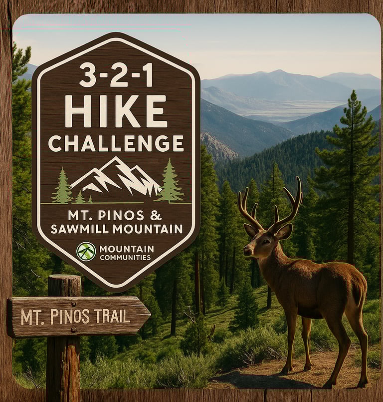
Take on the 3-2-1 Hike Challenge
Hike to the highest peaks of Kern & Ventura Counties
Looking for an active and scenic way to explore the Frazier-Tejon region? The 3-2-1 Hike Challenge is the perfect way to connect with nature, push your limits, and experience some of the most breathtaking trails in the Frazier-Tejon region.
Organized in partnership with the Mountain Communities Chamber of Commerce, this self-guided challenge invites both locals and visitors to summit three iconic peaks, log their journey, and earn recognition for completing the route.
What is the 3-2-1 Hike Challenge?
3 Hikes. 2 Counties. 1 Challenge.
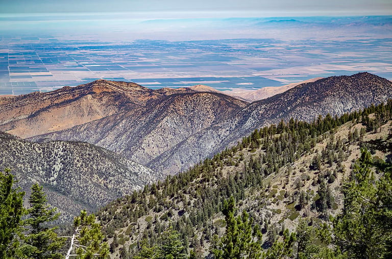
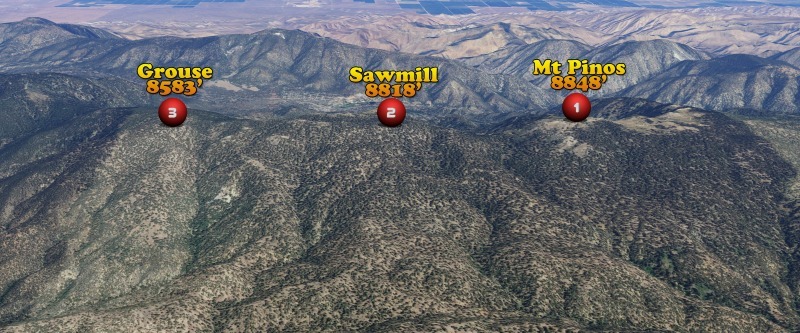
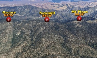
The goal is to summit three scenic peaks—Mt. Pinos, Sawmill Mountain, and Grouse Mountain—all located along the spine of the Los Padres National Forest. These peaks span both Kern and Ventura Counties, offering a journey through pine forests, ridgelines, and sweeping mountain views.
How to Participate
Download GPS tracks and info from mymountainchamber.com/321-challenge
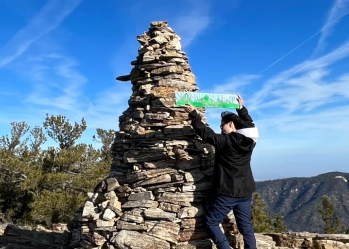
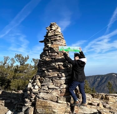
Take a photo at each summit (with the summit sign)
Email your photos to 321challenge@mymountainchamber.com
Allow up to 7 days for staff to verify your completion
✅ Upon approval, you’ll receive a digital Certificate of Completion and a link to purchase a commemorative patch (which includes a few surprise goodies!).
How to Get There
Set your GPS to:
📍 Mt. Pinos Nordic Base, located at the end of Mt. Pinos Road
This is where your out-and-back hike begins.
Trail Overview
Step 1: Mt. Pinos Summit
Trail: Mt. Pinos Summit Trail (wide, graded fire road)
Distance: ~1.7 miles one way
Elevation: 8,848 ft — Highest point in Ventura County
Step 2: Sawmill Mountain
Trail: Vincent Tumamait Trail (aka Mt. Pinos to Cerro Noroeste Trail)
Distance: ~1.6 miles from Mt. Pinos
Landmark: Pass Condor Observation Point
Elevation: 8,818 ft — Highest point in Kern County
⛺ Summit is marked by a cairn and register
Step 3: Grouse Mountain
Trail: Continue on Vincent Tumamait Trail
Distance: ~1.3 miles from Sawmill
Elevation: ~8,583 ft
🧭 Summit is accessed via a short, unmarked use trail on the right
➡️ Return the way you came to complete the hike.
Total Distance
One Way: 1.7 + 1.6 + 1.3 = ~4.6 miles
Round Trip: ~9.2 miles
Plan Your Highland Adventure
Trail Difficulty: ⭐️⭐️⭐️ (Moderate to Challenging)
Cumulative Elevation Gain: ~1,800–2,000 ft
Recommended For: Intermediate hikers or fit beginners
High Elevation Start: ~8,300 ft — pace yourself accordingly
Best Seasons: Spring and fall for optimal weather
What to Bring: Water, snacks, layers, sun protection, hiking boots
Why It’s Worth It
✅ Free to participate
👨👩👧👦 Great for families, friend groups, and solo adventurers
🧭 Encourages local exploration and wellness
🛍 Connects hikers with the community and local events
🏅 Earn a certificate and collectible patch for your efforts
Discover, Hike, Repeat.
Whether you’re a first-time visitor or a longtime local looking for new inspiration, the 3-2-1 Hike Challenge is your invitation to experience the wild, rugged beauty of the Frazier-Tejon Highlands—one peak at a time.